Ecology and Evolution · Skim version
Climate, Biomes and Environmental Variation
Read the full lesson → Skim the whole course →
The guiding idea
The Amazon and the Sahara are both hot. Why is one a rainforest and the other a desert?
Rain falls where moist air rises and cools and is scarce where air sinks and warms, and the warmer a month, the more rain it needs to count as humid; read month by month, warmth and water give a first guess at a place's biome.
From the film: Where the Rain Falls
- Sunlight striking at a slant spreads over more ground, so over a year the tropics get the most energy per square metre and the poles the least.
- Where moist air rises it cools and drops rain; where air sinks it warms and dries, which is why many deserts lie near 30 degrees north and south.
- The rain belt shifts north and south through the year, roughly following the overhead Sun with a lag, giving many tropical places a wet season and a dry one.
- On a Walter-Lieth climate diagram, a month is read as dry when its rain in millimetres is below twice its temperature in degrees C.
- Monthly warmth and water give a first guess at a place's biome, not a final answer.
From the film: Same Warmth, Two Answers
- Two places with similar average warmth can get different first guesses at the biome because of how much rain falls and when.
- Station A has no dry month and a tropical rainforest climate (Af); station B has five dry months on its climate diagram and a tropical savanna climate (Aw).
- In Staver and colleagues' analysis, at about 1,000 to 2,500 mm of rain a year with a dry season shorter than seven months (by their own measure), tropical tree cover was mostly either savanna-like or forest-like, rarely in between.
- Fire was associated with keeping savanna open; the proposed feedback is that fire can keep open areas open and a closed canopy can hold fire back, so the two may be alternative states under similar climates.
- A savanna climate does not guarantee a savanna: climate gives a first guess, and fire, soils, rain timing and microclimate can change the answer.
-
Warmth: over a year, sunlight per square metre falls with latitude
-
Water: where air rises and where it sinks
-
Oceans and mountains bend the pattern
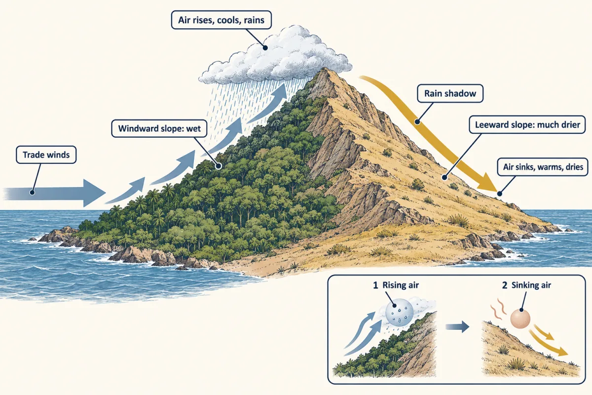
Moist air forced up a slope cools and drops its rain on the windward side; descending the far side it warms and dries, leaving a rain shadow. On mountainous islands such as Hawaii the windward slopes facing the trade winds are wet and the leeward sides much drier. AI-generated illustration -
Reading a climate diagram
-
Biomes are more than climate
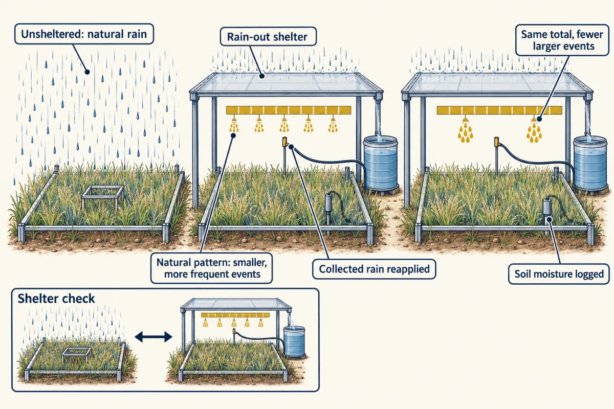
Holding the total rain constant while changing only the size and spacing of storms separates rainfall timing from rainfall amount. In Knapp and colleagues' grassland, fewer, larger storms lowered plant production; repeat it elsewhere before generalizing. AI-generated illustration -
Going deeper
Where this lesson fits
After thisStudy next
- Distributions, Niches and TolerancesThis course · Lesson 12
It takes climate and tolerance limits and asks where individual species can live, beyond the broad biome guess here.
- Diversity, Disturbance and SuccessionThis course · Lesson 19
It uses the fire and disturbance point from this lesson to explain how vegetation changes after disturbance.
- Global Change: Species on the MoveThis course · Lesson 24
It builds on the observed-versus-projected climate change distinction to ask how species ranges follow shifting climate.
Elsewhere on the siteFilms, simulations and method films in other courses
- Take a boat down the JamesSimulation · Life Science
Nonliving conditions such as temperature and rainfall help decide which living things can live where.
- Follow an atomSimulation · Biology
The rising and sinking air that brings or withholds rain also moves water between reservoirs.
Suggested by an AI model from the lessons themselves, then checked. How we use AI