Following Salt Down the James
Read the transcript of “Following Salt Down the James”
Film transcript: Following Salt Down the James
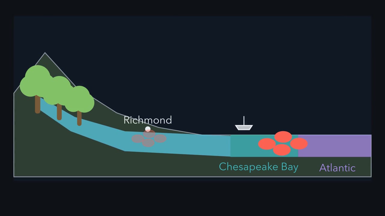
The first film separated living interactions from nonliving conditions. Can one nonliving condition predict where oysters might survive? Return to the same Virginia landscape. Follow salt from the upper James River to the mouth of the Bay.
Salinity is the amount of salt dissolved in water. The upper James is fresh, while ocean water is salty. In the Chesapeake estuary, river water and ocean water mix. Salinity usually rises toward the Bay mouth, but the mixing zone can move. A sampling boat starts at the upper tidal James. At each station, a probe measures the water below the surface. Each stop adds a point to the same river path. Watch the points climb as the boat moves toward the Bay. Now place an oyster beside the boat. Where along this fresh-to-salty path should oysters first find suitable water? Make a prediction before the boat moves again.
The oyster first fits the brackish lower river, not the fresh upper river. Eastern oysters can die when water stays very low in salt for a long time. Wild oyster reefs grow in the lower James, where the water is mixed. The measured station means make the gradient visible. Low values sit upstream, and higher values sit near the Bay mouth. The difference between two stations must be calculated, not guessed from spacing. The lesson table lets you subtract exact values and test the oyster range. Range matches are not sharp borders. Widgeon grass can fit every station listed. The oyster's range overlaps the eelgrass stations near the Bay mouth. The crews measured water; they did not count organisms at those stations.
Suitable salinity suggests habitat; it does not prove an organism was there. Salinity also shifts with rain and season. The boundary slides as fresh and salt water keep mixing. A station's value can change even though the river and Bay remain in place. One summer sample is a snapshot, not a permanent border. Salinity is powerful evidence, but it is only one condition.
Light, temperature, water movement, predators, and food can matter too. Living interactions and nonliving conditions help decide what can live where. The strongest explanation connects the pattern to both sides of the ecosystem. Use the station data to test that rule, with limits.
Why can oysters live in the brackish lower James River but not in its fresh water near Richmond?
Continue in the lesson: Land and Water Ecosystems →
3:06 · Free, with captions and a transcript. The lesson has the full text, the questions and the sources.
More films from this lesson
How this film was made. Narration: an AI narrator voice (Kokoro, af_heart) reading narration written from this lesson's text. Animation: AI-generated in code (Manim) by Claude, a schematic with no drawn molecular structures. Captions come from the narration script. See something wrong? Report it.